Maps of Hill Valley
These maps show my vision of Hill Valley. I've placed it to the east of the real-life town of Grass Valley, California, pretty much on top of the unincorporated community of Emigrant Gap. I've taken some liberty with the geography (I don't think you could actually fit a big town there) and I moved the county line east a bit as well. (Hill County replaces the real-life Nevada County.)
Hill Valley is located at an elevation of about 4600 feet (1400 m). It has warm summers and snowy winters. Its area code was 415 from 1947 to 1950; 916 from 1950 to 1997; and 530 after 1997. Its zip code is 95715.
Haysville is located to the southwest (not on the map); the unincorporated community of East Valley is not noted on these maps, but it's where five roads almost meet near the center of the map. It's across the county line in Placer County.
I've included only canon locations on this map, and excluded any locations that exist solely in my fanfics. I also haven't made an 1885 map, since all that'd be on it is the dot for Courthouse Square, the mountains, the river, and the lake.
1931
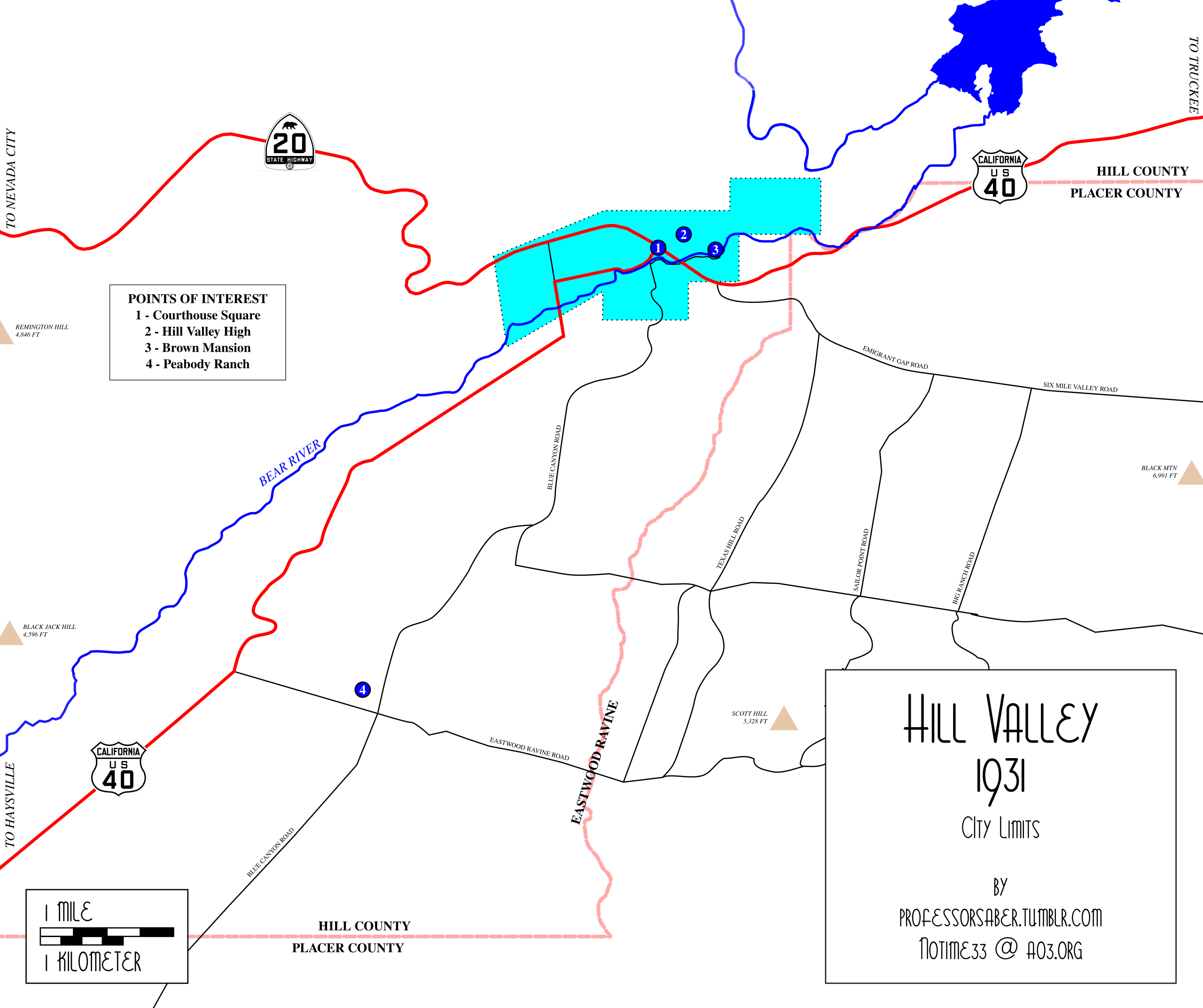
Area: 1.8 square miles; population 2,400; population density 1,300/sq mi
1955
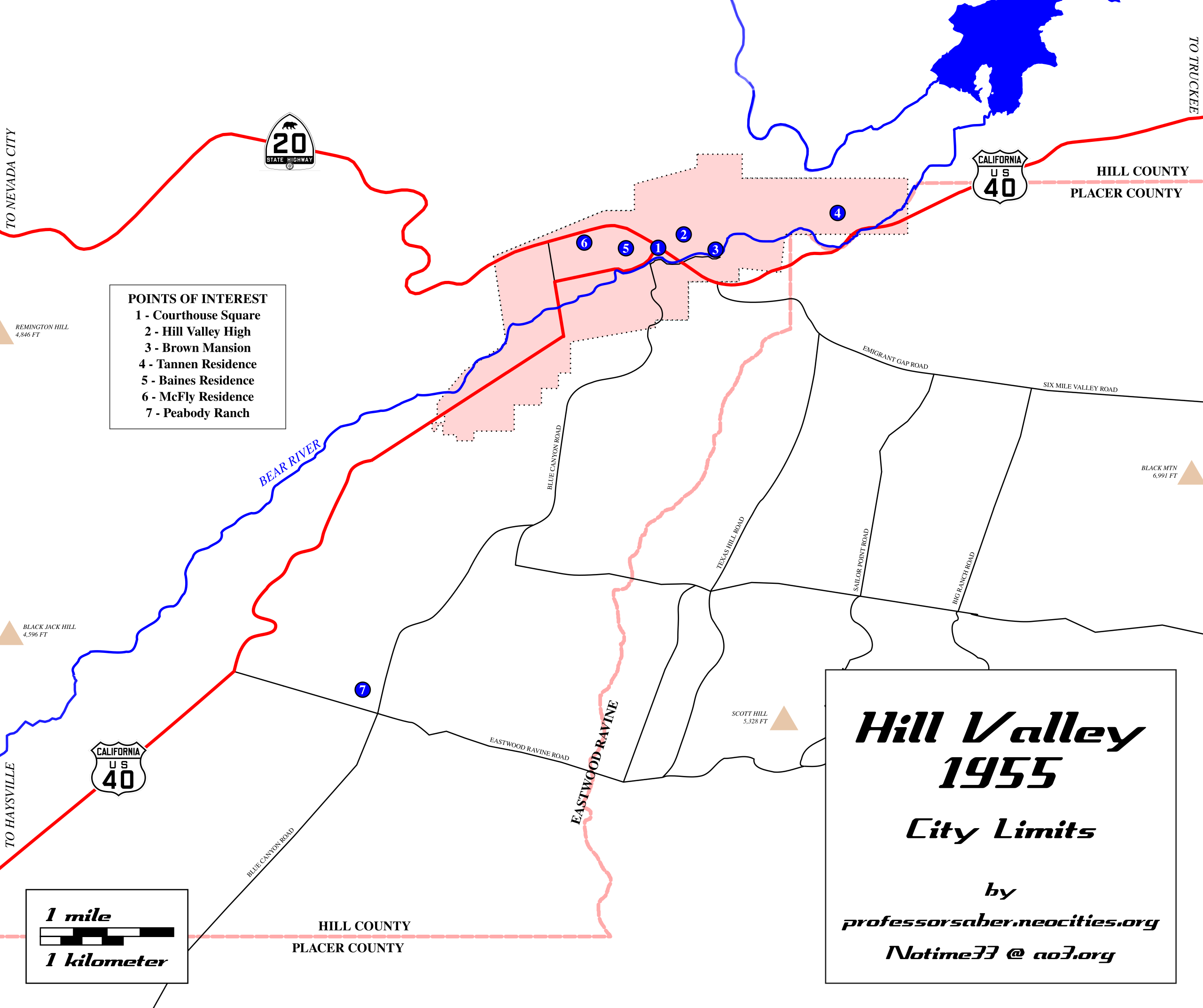
Area: 3.2 square miles; population 7,200; population density 2,250/sq mi
1985
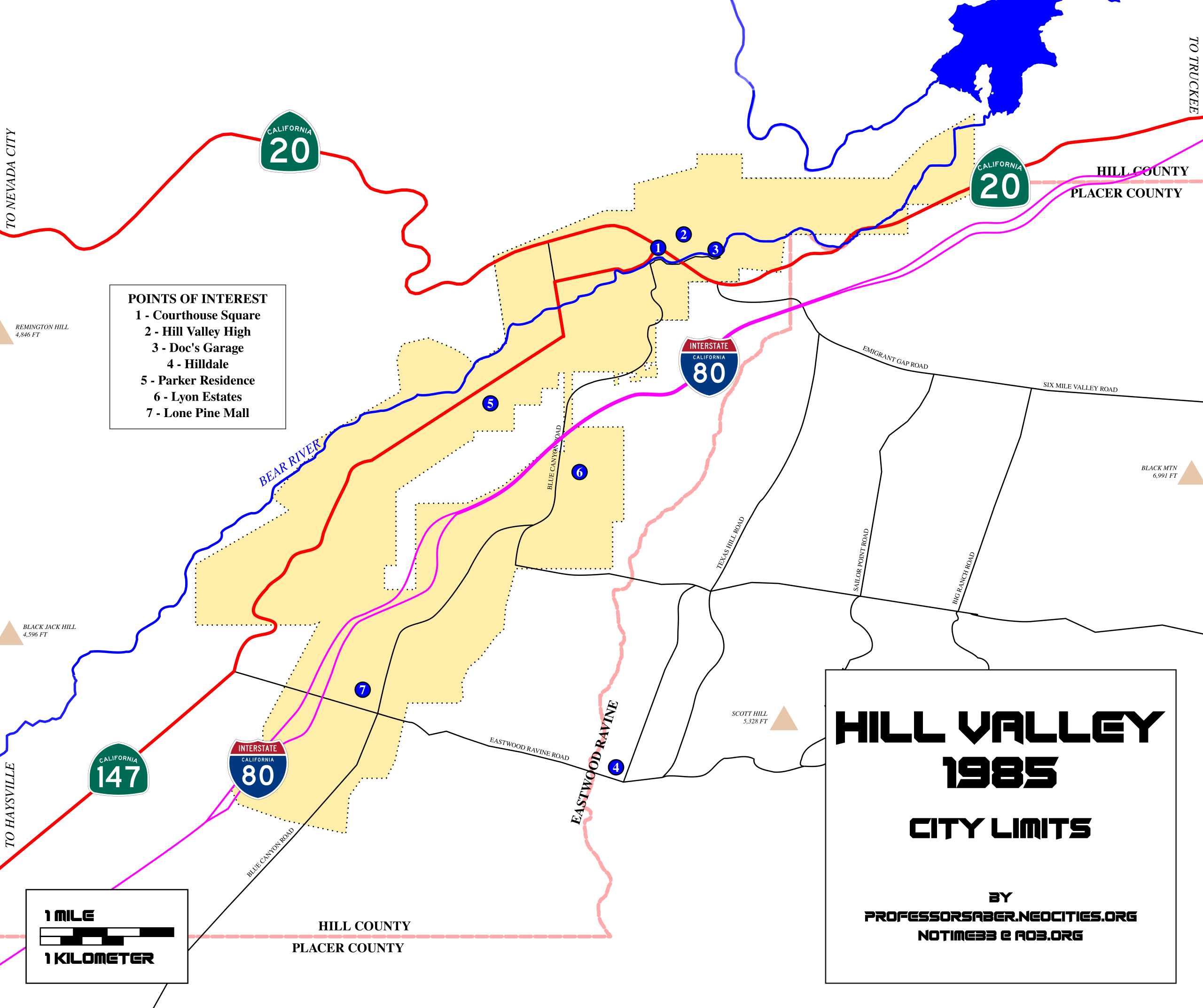
Area: 10.0 square miles; population 18,000; population density 1,800/sq mi
2015
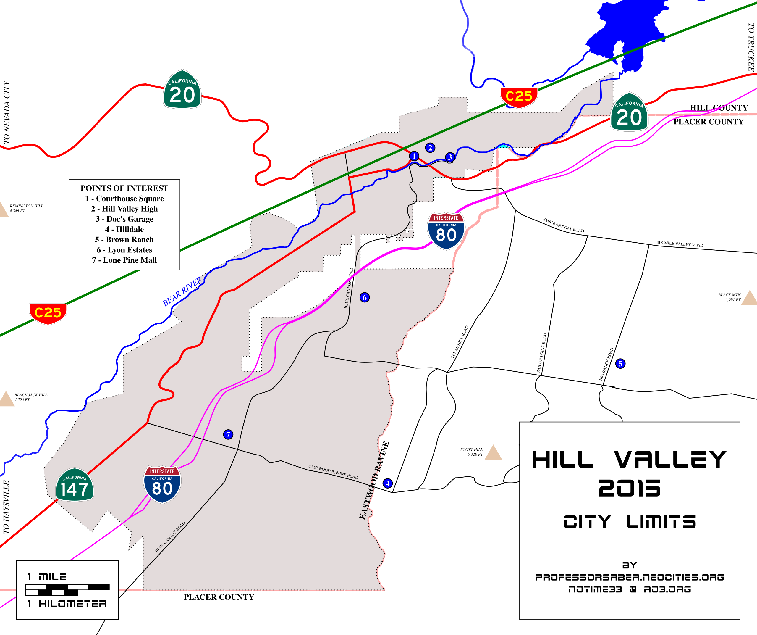
Area: 18.4 square miles; population 34,500; population density 1,875/sq mi
"C25" is the skyway.
[ BTTF ]